Showing posts with label Maps. Show all posts

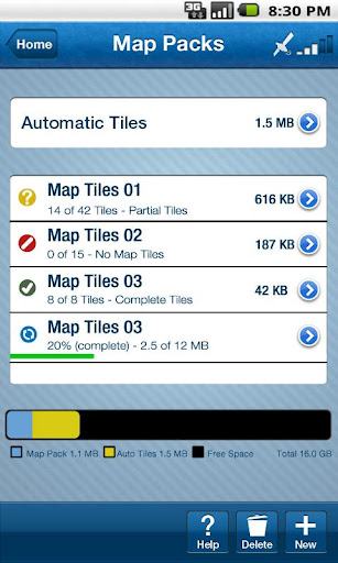
BackCountry Navigator PRO GPS v4.5.5 APK


GPS for the outdoors with offline topo maps !


BackCountry Navigator PRO GPS v4.5.5 play.google.com.backcountrynavigator.license
Use your phone or tablet as an offroad topo mapping GPS with the bestselling outdoor navigation app for Android! Explore beyond cell coverage for hiking, hunting and more.

Download topo maps for the US and some other countries in advance, so you won't need cell coverage when navigating.

This uses many publicly available map sources as free downloads. It also has some additional content available as an in app purchase:
  • Boundary maps for 12 western states from the Bureau of Land Management(BLM) for $7.99. Great for hunters, hikers, and prospectors. 
  • Content from US TrailMaps for $15.99, including:
  • Snowmobile Trail Maps for Snowmobiling enthusiasts, 
  • ATV Trail Maps 
  • Whitewater Trail Maps,
  • Equestrian Trail maps. 
See these in the menu under More-> "Purchasing AddOns".

You are welcome to try the DEMO version to make sure you like the maps in your country.

NOTE: If you've already purchased this or any paid app, you can install it at any time from 'My Apps' in the Android Market.

Use offline topo maps and GPS on hiking trails without cell service! The GPS in your Android phone can get its position from GPS satellites, and you don’t have to rely on your data plan to get maps. Have more fun and safe GPS adventures in the backcountry.

Preload offline topo maps, aerial photos, and road maps on your storage card, so they are ready when you need them for your GPS navigation. Many free map source are built into the app.

Add custom GPS waypoints in longitude and latitude, UTM or MGRS grid reference. Import GPS waypoints from GPX files. Choose mapsource-like icons for GPS waypoints. (This app uses the WGS84 datum, NAD27 is available in settings).

Use GPS for hunting a waypoint or geocache, for recording tracks and GPS waypoints on your trip, all the while tracking your GPS quest on topographic maps.

What's in this version : (Updated : Jun 8, 2012)
  • New Map Source: 4umap: Free Topographic map of Europe
  • New Map Source: Catalunya
  • Kml Import fixes
  • Customize GPS Pointer Color
  • Turn individual tracks on/off.
  • Accuterra topo maps, multilayer US map source, added as purchasable upgrade.
  • Addons include Accuterra map source,SnowMobile trail maps, ATV, Equestrian, Birding, and Whitewater trail maps, and BLM Land Boundary Maps of 12 western states.
Required Android O/S : 1.6+

Screenshots :


Download : 3.2Mb APK
Continue Reading...

Backpacker GPS Trails Pro v5.1.0 APK


Find hiking trails, view topo maps and navigate with GPS & compass!


Backpacker GPS Trails Pro v5.1.0play.google.com.outdoors.backpacker
Find hiking trails, view topo maps and navigate with GPS & compass.
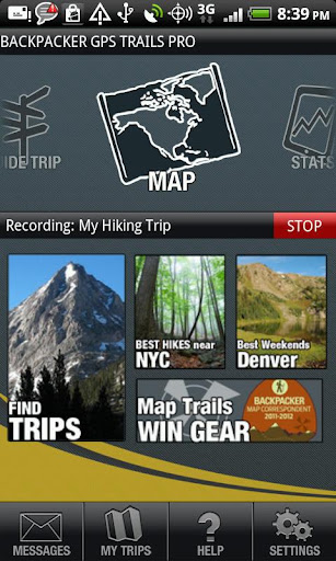
Record hiking trails, backpacking trips, and camping adventures with Backpacker GPS Trails Pro. View maps, navigate with GPS and digital compass, take photos, and backtrack to the trailhead.

GPS Trails Pro works in remote places like national parks, wilderness areas, and backcountry spots without relying on data and cell signals.

Features:
  • Turn your phone into a GPS: Navigate via precise satellite signals in and out of cell network.
  • Capture waypoints: Mark campsites, trailheads, water sources, summits, and more.
  • Track every step: Record or follow your tracks and routes. Store unlimited tracks.
  • Share your trip: Post adventures to backpacker.com, Twitter and Facebook.
  • Geotag your photos, videos, and sound clips: Save coordinates with every image and see their exact location on a map. Auto-save videos to your YouTube account too.
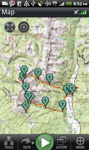
  • View maps: See unlimited street maps, aerial photos, hybrid street/aerial maps, and topo maps provided by MyTopo.
  • Navigate on the trail: Be an expert backcountry navigator. Use the digital compass to follow bearings or go to waypoints on the trail.
  • Save maps: Store offline topos and other maps on your phone for viewing in remote areas.
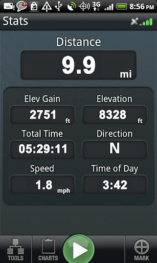
  • View stats: See 10 stats, including elevation, speed, and distance.
  • Pick your coordinates: Choose latitude/longitude or UTM and WGS 84 or NAD 27 then use GPS Trails for advanced navigation with traditional paper maps.
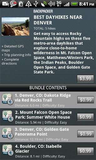
Download Pro Trips: Follow our step-by-step trail guides of popular trails and lesser-known routes in national parks, national forests, and local parks, including Yellowstone, Yosemite, Grand Canyon, Great Smoky Mountains, Glacier, Rocky Mountain, White Mountains, Adirondacks, Catskills, Zion, Arches, Canyonlands, Acadia, Mount Rainier, Everglades, Olympic, and more. Find hikes near major cities: New York City, Seattle, Portland, LA, Denver, Chicago, Boston, Atlanta, and more. Plus find section hikes on the Appalachian Trail, Pacific Crest Trail, and the Continental Divide Trail.

Search trips: Find thousands of trips shared by the Backpacker.com community.

Plan trips: Draw routes with our free web-based map software (backpacker.com/postatrip) or BACKPACKER Map Maker for iPad (backpacker.com/mapmaker), then sync them wirelessly in the Backpacker Trip Cloud.

Upload GPS files: Load your own .gpx files at backpacker.com/postatrip.

Get published: Every month the editors at Backpacker handpick adventures shared by its online community to be published in the magazine. Kickstart your adventure writing and photography career with GPS Trails.

MORE INFO
Supported Phones: GPS Trails Pro is designed and optimized for the Android phones.

Battery Life: While we optimize our code to cut down on power requirements, continued use of the GPS running in the background can dramatically decrease battery life. For longer dayhikes or overnight trips, we suggest packing lightweight battery packs to charge the phone.

Follow Us: We’ve created a Facebook page for our mobile apps to discuss upcoming releases, new features, and your feedback. Your feedback helps us create a better app. Go to: facebook.com/backpackergpstrails.

What's in this version : (Updated :Jun 5, 2012 )
  • Added the ability to move waypoints after marking them
  • Added tab to preview a trip's map without making it the active trip
  • Added pagination on the Pro Trips list
  • Additional options in the Layers screen
  • Improvements to handling of in-app purchases
  • Various UI enhancements
  • Miscellaneous bug fixes & improvements
Required Android O/S : 2.1+

Screenshots :


Download : 6.5Mb APK
Continue Reading...

Trimble Outdoors Navigator Pro v5.1.0 APK


GPS, offline topo maps, aerial photos & compass for hiking, ATV & offroad trails!


Trimble Outdoors Navigator Pro v5.1.0/play.google.com.trimble.outdoors.navapp
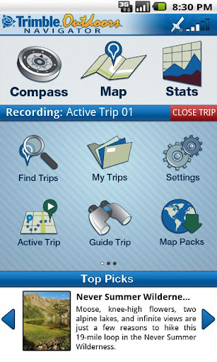
Change the way you explore. Trimble Outdoors Navigator is a GPS navigation and mapping app for all your outdoor and backcountry adventures. View more than 68,000 topo maps in US and Canada, as well as aerial, terrain, street and hybrid maps. 

Mark waypoints, capture photos and video and store all your trip info on the Trip Cloud, a wireless service that allows you to access your trips on any device.

This app is BEST FOR: GPS route finding; map and compass navigation; offline topo maps; recording trips like hiking, camping, paddling, ATV riding, offroading

START WITH GREAT MAPS
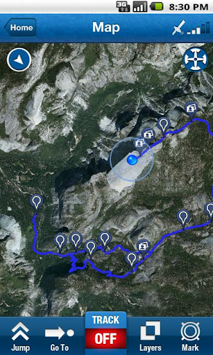
  • View five different map types: streets, hybrid, aerial, topo and terrain. 
  • Take your maps anywhere. Save maps on your Android for offline viewing in far-flung places without the need of a cellular or data signal. Just preview the maps you want before you leave for the trip. 
  • Get exclusive and enhanced topo maps from MyTopo. Access more than 68,000 topo maps in US and Canada that are seamlessly stitched together for fast and easy viewing. Topos scales are 1:24K in the Lower 48, 1:63K in Alaska and 1:50K in Canada. 
  • Save map packages onto your Android phone for viewing maps in remote areas.
POWERFUL NAVIGATION TOOLS
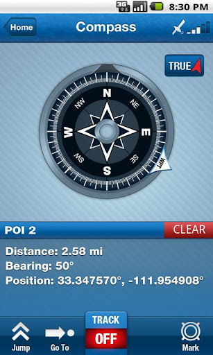
  • Digital Compass: Navigate with digital compass. Choose between: Magnetic North and True North. 
  • Waypoints: Mark waypoints like trailheads, summits, important turns, and campsites on to the map. Add names and detailed descriptions. Go to previous marked waypoints too. 
  • Tracks: Track your route on the map. 
  • Goto: Use the Goto feature to navigate from your current location to a waypoint. 
  • Coordinates: Match your latitude/longitude or UTM coordinates to your paper map or GPS device. Supported map datum: WGS84 and NAD27. 
  • Guide Trips: Use trips previously recorded by you or others to help guide you on the trail, on remote backroads, and more.
CHRONICLE YOUR ADVENTURE
  • Capture Media: Take geo-tagged photos, videos and audio clips of your trip 
  • Stat Tracking: See 10+ adventure stats, such as distance, speed, elevation and more 
  • Share with Friends: Share your adventure on Facebook, Twitter, YouTube and TrimbleOutdoors.com 
  • Trips: Access to thousands trips around the U.S. and Canada
SAVE TO THE TRIP CLOUD 
Register a free account to save your outdoor trips to our Trip Cloud. Benefits include:
  • Store and backup unlimited trips. Never lose files again. 
  • Auto-sync trips between your computer, Android and iPad. 
  • Enhance trips from Trimble Outdoors Navigator with FREE map tools at trimbleoutdoors.com, including .gpx import, geo-tagged photos and videos, turn-by-turn routes and more. 
  • Open trips in our iPad trip-planning app, Trimble Outdoors MyTopo Maps. 
  • Share and exchange trips with the Trimble Outdoors community or privately between outdoor friends.
What's in this version : (Updated : Jun 5, 2012)
  • Added the ability to move waypoints after marking them
  • Added tab to preview a trip's map without making it the active trip
  • Added pagination on the Pro Trips list
  • Additional options in the Layers screen
  • Improvements to handling of in-app purchases
  • Various UI enhancements
  • Miscellaneous bug fixes & improvements
Required Android O/S : 1.6+

Screenshots :


Download : 9.5Mb APK
Continue Reading...

Flightradar24 Pro v3.2 APK


Flightradar24 Pro' shows airplane traffic around the world in real time !


Flightradar24 Pro v3.2 play.google.com.flightradar24pro
Flightradar24 is a flight tracker, that makes it possible to view airplane traffic, in real time, on a Google Map in your Android phone/tablet. Flightradar24 has the best coverage of all flight trackers in Europe and together with many great features, Flightradar24 has become the most popular flight tracker in most countries around Europe.

COVERAGE
 Apart from Europe there is some coverage in Russia, USA, Canada, Australia, New Zealand, Greenland, South Africa, Brazil, Argentina, Japan, Hong Kong, Malaysia, India, Maldives, Middle East and some other parts of Asia.

Features:
  • View full aircraft info, route info and picture of the aircraft.
  • View flight trails and callsigns directly on map.
  • Possibility to show airline logos in connection with the aircraft.
  • Aircraft moving in real time.
  • Search for flights (flight numbers and call signs).
  • Emergency squawk notifications.
  • Filters to view flights from just one airline.
  • Augmented Reality (AR).
AR VIEW
Augmented Reality makes it possible to point the camera to the sky and view information about air traffic above your head. The AR feature require a GPS and compass to work correctly.

IMPORTANT
Flightradar24 can only track aircraft equipped with an ADS-B transponder. Visit http://www.flightradar24.com/ to get more information about Flightradar24 coverage and ADS-B.

What's in this version : (Updated : Jun 4, 2012)
  • New aircraft graphics
  • Updated (smaller) data feed format (less data to download)
  • Speed and altitude in popup window is now updated after every feed update
  • Added from-now-to trail
  • Fixed issue with "follow plane" option
  • Several fixes in AR mode
  • Possibility to search for a reg
  • Possibility to show reg beside an aircraft (option: None / Callsign / Reg / Airline Logo)
  • Added new airline logos
  • Several small bug fixes
Required Android O/S : 2.1+

Screenshots :


Download : 3.4Mb APK
Continue Reading...

Locus Pro v2.4.2 APK


MULTI-FUNCTION TOURIST NAVIGATION !


Locus Pro v2.4.2 market.android.com.locus.pro
MULTI-FUNCTION TOURIST NAVIGATION
Irreplaceable application for hiking, geocaching and your everyday life.
Locus offers many useful features such as :
  • Online maps (browsing and downloading) 
  • Offline maps 
  • Navigation (online calculation tracks) 
  • Vector maps 
  • WMS service 
  • Track recorder 
  • Integration of Google My Maps (reading and editing) 
  • Geocaching 
  • Parking 
  • Weather service 
  • Point of interest 
  • POI alert 
  • Search (by adress, coordinates, contact) 
  • Custom screen (created by community) 
  • Integration of GPSies, Breadcrumbs, Street View and other 
  • API for developers
Features :

ONLINE MAPS
OpenStreet maps (16 types), Freemap (4 types), ArcGIS (4 types), SHOCart (4 types), MapQuest (3 types), Navigasi (1 type)
Most of the maps can be used in offline mode. Selection of maps is still expanding. If you have a favorite map, which you don't find in Locus, please let us know and we add the maps to Locus (condition is that Locus corresponds with terms of use of map providers).

OFFLINE MAPS
Support for SQLite, TAR maps, MBT maps, GEMF formats.

GEOCACHING – complet offline
Support for import Pocket Query files, Field notes (ability to pre-fill), load all waypoints for all POIs, graphical calculations (intersections of circles, intersection of lines) and many other tools for geocaching.

VECTOR MAPS
Vector maps of the whole World in Locus.
Possibility to easy and fast downloading of maps thanks to addon, which can be bought to Locus Pro for 1€. The biggest advanteges are small size and quality of maps in all scales.

WEB MAP SERVICE – online
The service allows to display map layers (thematic maps) of geographical informations, that are provided for public by individual institutions.

What's in this version: (Updated : Jun 3 ,2012)

  • Minor update - bugfix especially for geocachers
  • (Don't update, if you don't want. If there will be no more serious problems, next update will take some time)
  • add: new online 4UMaps (OSM based hiking maps for Europe)
  • add: possibility to delete recorded track also from widget
  • add: import/export caches together with Personal notes
  • fix: icons for newly imported geocaches (please re-import if you'll still have problems)
  • fix: small reported issue
Required Android O/S : 1.6+

Screenshots :


Download : 4.4Mb RAR (Use Custom patch to remove license verification)

Continue Reading...

BackCountry Navigator PRO GPS v4.5.4 APK


GPS for the outdoors with offline topo maps !


BackCountry Navigator PRO GPS v4.5.4 play.google.com.backcountrynavigator.license
Use your phone or tablet as an offroad topo mapping GPS with the bestselling outdoor navigation app for Android! Explore beyond cell coverage for hiking, hunting and more.

Download topo maps for the US and some other countries in advance, so you won't need cell coverage when navigating.

This uses many publicly available map sources as free downloads. It also has some additional content available as an in app purchase:
  • Boundary maps for 12 western states from the Bureau of Land Management(BLM) for $7.99. Great for hunters, hikers, and prospectors. 
  • Content from US TrailMaps for $15.99, including:
  • Snowmobile Trail Maps for Snowmobiling enthusiasts, 
  • ATV Trail Maps 
  • Whitewater Trail Maps,
  • Equestrian Trail maps. 
See these in the menu under More-> "Purchasing AddOns".

You are welcome to try the DEMO version to make sure you like the maps in your country.

NOTE: If you've already purchased this or any paid app, you can install it at any time from 'My Apps' in the Android Market.

Use offline topo maps and GPS on hiking trails without cell service! The GPS in your Android phone can get its position from GPS satellites, and you don’t have to rely on your data plan to get maps. Have more fun and safe GPS adventures in the backcountry.

Preload offline topo maps, aerial photos, and road maps on your storage card, so they are ready when you need them for your GPS navigation. Many free map source are built into the app.

Add custom GPS waypoints in longitude and latitude, UTM or MGRS grid reference. Import GPS waypoints from GPX files. Choose mapsource-like icons for GPS waypoints. (This app uses the WGS84 datum, NAD27 is available in settings).

Use GPS for hunting a waypoint or geocache, for recording tracks and GPS waypoints on your trip, all the while tracking your GPS quest on topographic maps.

What's in this version : (Updated : Jun 1, 2012)
  • Fix: Avoid incomplete/corrupt tiles that could occur in slow connections. Use recycle to delete previous ones. Customize GPS Pointer Color
  • Turn individual tracks on/off.
  • Accuterra topo maps, multilayer US map source, added as purchasable upgrade.
  • Germany/Austria Map fix.
  • The newsletter is *not* required for software updates, Robert.
  • Addons include Accuterra map source,SnowMobile trail maps, ATV, Equestrian, Birding, and Whitewater trail maps, and BLM Land Boundary Maps of 12 western states.
Required Android O/S : 1.6+

Screenshots :


Download : 3.2Mb APK
Continue Reading...